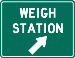
Highway: I-71 NB
Mile Marker: MM 49
City: WILMINGTON
State: OH
Phone: 937-382-6552
Parking: Exit 32 has a Country Kitchen restaurant with truck parking and there is a rest area at mile marker 34 south of the Clinton County weigh station. There is a small Pilot truck stop at exit 50 north of the truck scale.
Alternate Route Information
Coming from Cincinnati heading toward Columbus, you can take I 75 north, instead of I 71, to exit 43 for I 675 north to the end and take I 70 east to Columbus, depending on where you are going in Columbus this can actually be shorter mileage and it is all freeway.
If you want to stay on I 71, take exit 45 for route 73 and turn right off the ramp. You’ll go 7.4 miles into Wilmington. You’ll go past where route 73 turns into two one way roads and stay on route 73. You’ll go past Josephine (a sign “no truck turns”) and bear left, staying on West Main Street which is 73 E. You’ll pass Clinton Memorial Hospital on your right and go through the light at Mulberry Street to the light at South Street. Turn left on South Street which is marked at route 68 north. The Convention Center and Visitor’s Bureau will be on your left and Ken Gosney Photography will be on your right at the intersection. You’ll turn left onto route 68 north and go .6 miles to Lorish Avenue/Xenia Avenue and turn left- this still following route 68 which turns left here. After you make that turn you’ll see a possible area for DOT to set up portables on the right in about a mile. From the turn on Lorish/Xenia you’ll go 4.6 miles back to the ramp for I 71 north.
If DOT is set up on route 68, don’t turn onto South Street. Continue through town and follow route 22/route 3. You’ll go about 9 miles past the route 68 turn out into the farm fields to the flashing yellow light at route 72. Turn left on route 72 and go 5.9 miles back to I 71 and turn north (if you go south you will have to cross the south bound I 71 scales if they are open).


